
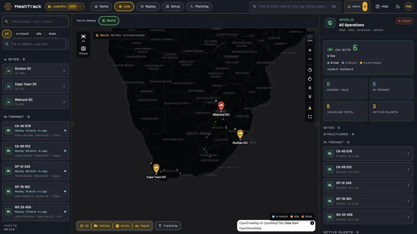
Yard, fleet and warehouse on one map.
Trucks between depots on GPS trackers. Forklifts, cages and pallets inside the DC on the mesh. Gates, docks and customers as geofences. One operational map, with the same alerts, reports and replay for all of it.
The problem
The questions you can't answer today.
“Where is every truck, and how long did it wait at the gate?”
Time lost at gates and docks never shows up anywhere.
“Where did the forklifts, cages and trolleys go?”
The equipment that keeps the warehouse moving goes missing or stands idle.
“Where is the day being lost?”
No view of dwell in staging, at the docks or in the yard, or of when the floor is busiest.
“Why are the yard, the fleet and the buildings on three screens?”
Each lives in its own system, so nobody sees the whole operation.
How MeshTrack answers them
One platform, from the map to the report.
Vehicles, equipment and people are first-class on the same map, so the trip and what happens at the dock are one story.
Vehicles between depots
Position, speed, trips and driver for every vehicle. Readings are stored when out of coverage and sent later.
Geofences for gates, docks and customers
Polygon, circle or corridor, imported by CSV if you have them. Site/Depot, Customer/Delivery, Receiving, Dispatch, Parking/Yard, Checkpoint, Restricted and Route corridor types.
Entry, exit, dwell and speed
Trigger on entry, on exit, on dwell, or on speed inside a geofence, by email, push, SMS or Telegram.
Forklifts, cages and pallets on the map
Search any forklift, cage, trolley or scanner and the map flies to it inside the DC.
Utilisation and idle
What is used and what stands idle, and alerts when equipment leaves its area or goes quiet.
Dwell, busy hours and congestion
Dwell per zone at docks, staging and yards; busy hours and zone traffic reports.
Replay any route
Replay a vehicle, a building or a whole site at 0.5× to 15×, over 30 minutes, 2 hours, a day or a custom range.
Evidence for customers
Trips, dwell, utilisation and movement history, with the Report Builder, CSV export and scheduled email delivery as CSV or PDF.
Into your WMS, TMS and BI
A REST API and event stream feed your systems; signed webhooks pass alerts to your control room.
The technology mix
GPS on the road. Mesh or Bluetooth in the DC.
Each technology does what it is good at, and the hand-over happens at the gate and the dock door. Everything lands on the same map.
Trucks and vans on the road
GPS/LTE trackers
Teltonika FMB920 or FMC130, or any Teltonika GPS tracker, on your own SIMs. Position, speed and ignition, plus CAN data on supported models. No site hardware.
Inside the DC
Wirepas mesh or Bluetooth gateways
Wirepas battery anchors for about 5 m accuracy across the floor; Bluetooth gateways for room or zone level where there is network.
Gates, docks, yards and customers
Geofences
Drawn on the map or imported by CSV, with entry, exit, dwell and speed-inside triggers.
Trailers and returnable assets outdoors
GPS asset trackers
Teltonika ATC700, ATC704 (with Bluetooth) or the long-life ATC774.
Drivers and floor teams
Mobile app
Live map, search and alerts on iPhone and Android, and "Track this phone" where a person needs to be on the map.
MeshTrack is vendor- and technology-agnostic: several technologies can share one site, and every reading feeds the same map, alerts, reports and replay. See the platform.
Outcomes
What changes.
- 01
The fleet between depots
Every vehicle with its trips and driver, and its routes on replay.
- 02
Time at gates and docks, measured
Geofences for gates, docks and customers, with entry, exit and dwell.
- 03
Equipment found and used
Forklifts, cages and pallets on the map, with utilisation.
- 04
Where the day goes
Dwell per zone, busy hours and congestion.
- 05
Your systems, fed
The API feeds WMS, TMS and BI.
Start small
Start with one DC, or one fleet.
Prove it on one site against success criteria agreed up front, then add depots and vehicles as you grow.
- 1 Pick one DC or one fleet.
- 2 Fit GPS trackers to the vehicles, and draw the depot, gates, docks and customers as geofences.
- 3 Tag the forklifts, cages and trolleys, with an anchor or gateway layout reviewed before installation.
- 4 Measure against the agreed criteria, then add the next site.
Related
The same platform, elsewhere.
Mining
Underground and open pit
Underground Now level by level, muster and roll-call, blast clearance, and the surface fleet on geofences. Supports your Regulation 16.7 duty.
Read moreHealthcare
Hospitals, clinics and groups
Find equipment on its floor and in its room, see what stands idle, and watch rooms and fridges.
Read moreIndustrial & manufacturing
Plants and factories
Contractors in danger zones, muster head-counts, and tools with utilisation.
Read morePeople & safety
Who is on site, and where
Shifts, On site and Underground Now, muster, restricted zones and panic buttons, with an open privacy model.
Read moreLogistics & warehousing
See the whole operation, door to door.
Tell us about your depots, your fleet and the equipment that keeps the warehouse moving.